A Veritas Imagery service

Hyperspectral imaging — seeing what colour alone can't tell you.
A conventional satellite records three broad colours. A hyperspectral sensor records hundreds of narrow, contiguous ones — enough to recognise a material by the way it reflects light. Hypervision brings that capability to market from orbit, with regular global coverage.
The difference
Three bands, or three hundred.
Standard optical imagery divides visible light into red, green and blue. Hyperspectral divides a far wider range — out through near infrared and into shortwave infrared, to around 2,500nm — into hundreds of narrow, contiguous slices. It is the shape of that curve, not the colour, that identifies what is on the ground.
Standard optical
3 broad bands
Hyperspectral
Hundreds of contiguous bands
Every pixel is a spectrum
Not a wider picture. A deeper one.
The footprint on the ground is the same in all three cases. What changes is how much sits behind each pixel of it — three numbers, a dozen, or several hundred. That depth is the data, and it is what a material can be identified from.
Capabilities
What the spectrum gives you.
Material identification
Spectral signaturesEvery material reflects light in a pattern of its own. With hundreds of narrow bands rather than three broad ones, that pattern can be matched against a library — so the question moves from what colour is it to what is it made of.
Vegetation and crop health
Red edge · NIRStress, species and moisture content register in the spectrum well before they show as visible change, making problems detectable while there is still time to act on them.
Minerals and soils
SWIRAlteration minerals, clays and iron oxides each carry diagnostic absorption features, supporting exploration targeting and ground characterisation from orbit.
Gas and plume detection
EmissionsCertain gases absorb at known wavelengths, so releases can be identified and attributed rather than merely observed as a haze.
In practice
What the bands are for.
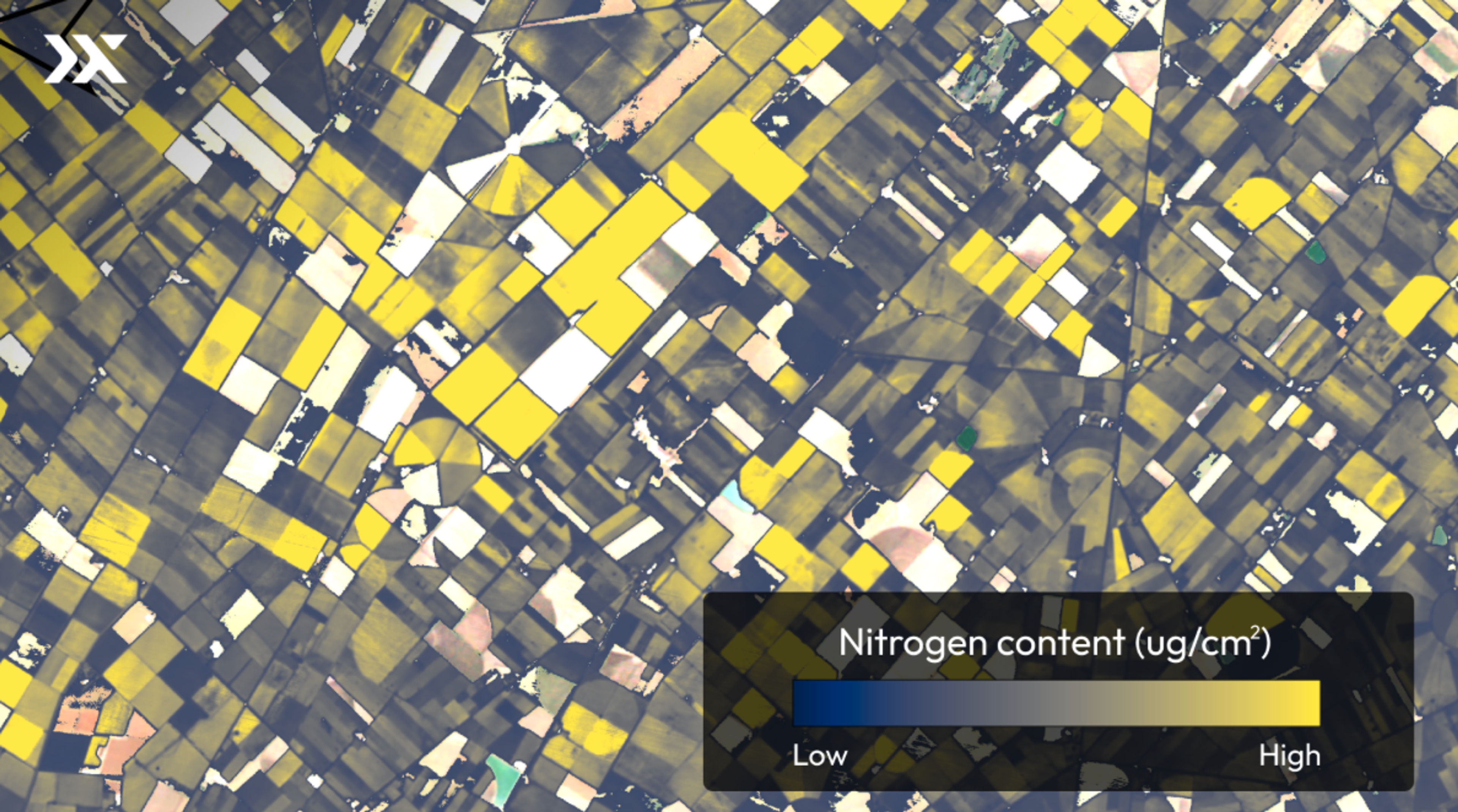
Four products from four different sensors. Each one is derived from a reflectance curve rather than from what the scene looks like, which is why none of them could be produced from a conventional image of the same ground.


Applications
Where it changes the answer.
Anywhere the question is what something is, or what condition it is in, rather than simply where it is.
Sourcing
The sensors behind it.
Hyperspectral data has historically come from aircraft. We source it from orbit, through the operators building constellations specifically for it.
Tell us what you need to identify.
Send us the area and the material or condition you're trying to detect, and we'll advise on whether hyperspectral is the right instrument for it.